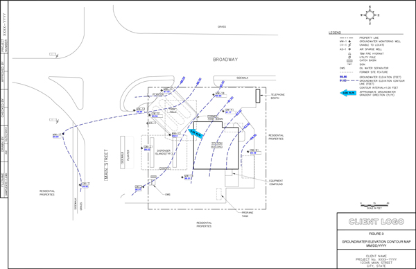
Groundwater Elevation Contour Maps
Groundwater Elevation Contour Maps are part of Phase II Environmental Assessment Reports, conducted at sites where there is known or suspected groundwater and/or soil contamination. Phase II ESA report is an initial screening of groundwater and soil to determine if there are contaminants present. If contaminants are found to exceed federal or state local cleanup standards, additional site characterization is required in order to determine the extent of contamination, and required remediation.
Groundwater Elevation Contour Maps are also part of groundwater remediation and monitoring reports.
Groundwater elevation data are provided in MS Excel format, including the following information: site number, gauging date, quarter and year for which the map is being made, well numbers and their coordinates, ground water levels/elevations.
All figure requests are made in our cloud-based work management system on a fixed-price basis, and figures are completed within 7 days.